Skip to content

Boston’s go-to local guide

200,000+ Bostonians use Secret Boston to find the city’s best spots and events.

The Move

Coming up in Boston

374 events

Full calendar →

Places to go

Explore places →

Guides

5 Boston bars for a hot toddy crawl

The first cold night in Boston is a reminder that pumpkin beer is not a winter strategy. Order something hot, strong, and made by someone who cares. These five stops, four with booze and one without, split into two walkable legs. Do both in one night if you like, or treat them as separate evenings and skip the long gap between Kendall and Fort Point. Start in Davis Square, then cross into Kendall. The walks are short. The drinks get less classic as you go. Batifol is where you should eat something before the toddies add up. Foundry on Elm is the purist stop. Their Hot Toddy is a clean, balanced classic of bourbon, lemon, honey, and clove. Nothing clever. Just done right. If someone in your group wants mulled wine or an adult hot chocolate instead, Foundry carries those too, including non-alcoholic versions. Start here at 255 Elm Street in Somerville, then head toward Kendall on the Red Line or a short rideshare. State Park sits downstairs in One Kendall Square, in the Alexandria Plaza lower level. It is the dive bar with the toddy nobody expects. The Hot Hibiscus Toddy mixes apple brandy and Bénédictine with pomegranate, hibiscus, ginger, and lemon, served steaming. Tart, bright, and stronger than it looks. This is the drink that turns the crawl from classic to interesting. Five minutes away at 291 Third Street, Batifol is full Paris brasserie mood. Order La Folie Douce, a hot drink of whiskey and Drambuie with maple syrup, lemon, and orange juice. It is a toddy in everything but name. Stay for the onion soup. If you want a second winter warmer, Batifol also pours L’Après Ski, a hot red-wine drink with brandy, citrus, apple, and spice. Five toddies is not a dinner. Eat here before you keep going. The second leg sits on the other side of the river. Uber the gap, or save it for another night. Matria is the pause for anyone skipping alcohol. The Envoy rooftop is the finale once the winter igloos are up. Matria, inside the InterContinental Boston at 510 Atlantic Avenue, is the non-alcoholic pick. The Twilight Toddy has no booze at all. It is built on lemon and honey with chamomile and cinnamon. Bring the friend who is not drinking, or take a break mid-crawl. The room looks out over the waterfront, which helps when the first leg has already done its work. No hangover from this round. From here, the walk to the Seaport is short. Rooftop at The Envoy is the finale, but time it for winter, when the heated igloos go up seven floors above the harbor at 70 Sleeper Street. Igloo seats are reserved, usually for small groups of about four to eight, and they go quickly on weekends. The toddy changes with the season’s gin sponsor. Last winter it was the Gin-gle Bell Hot Toddy made with Empress 1908 Gin. Book an igloo if you can. If not, the rooftop bar still runs walk-up seating when it is open. End the night here. Two legs, two nights works cleanly. One night works if you Uber between Kendall and Fort Point. Go on a weeknight. Igloos and prime seats disappear on weekends. Eat at Batifol. Confirm the current toddy names before you go. Seasonal menus move around, and the Envoy drink in particular changes with the sponsor. If the fire, the igloo, or a specific drink is the whole point, call ahead the day you go.

Best pumpkin patches in the Boston area

A pumpkin trip can be a quick stop for something to carve or an afternoon involving a wagon ride, apple picking and several doughnuts. Before choosing among pumpkin patches in the Boston area, decide which version you want. The activities, admission arrangements and distance from the city vary considerably. These four farms are in Harvard, Tyngsboro, North Andover and Northborough. They are day trips out of Boston, and their pumpkin offerings are seasonal. Check the farm’s daily update before leaving, particularly after rain. A farm store can be open while its fields or wagon rides are closed. Westward Orchards takes visitors to its pumpkin patch by wagon on fall weekends. Its 2026 schedule runs from September 19 through October 18, with rides from 11 a.m. to 4 p.m. Rain stops the wagon, so this is one to check again on the morning of your visit. The farm also sells pumpkins, gourds and seasonal decorations around the store, which gives you an alternative if you only want to shop. Add apple picking while the orchard is open, or buy apples, cider doughnuts and produce inside. Pumpkin-patch rides and the store have different hours; an open shop does not mean the wagon is still running. Parlee grows its pumpkins on the farm, then moves them into a display patch for visitors to choose from. You are selecting a harvested pumpkin rather than cutting one from a vine. That distinction is useful if the field-picking experience is the whole reason for your trip. There is enough else here to fill an afternoon: apple picking in season, cider doughnuts, warm apple crisp and Annie’s Animal Barns. The farm’s daily news page lists what is open, picking deadlines and food service. Its regular fall schedule closes the farm on Mondays. Activity hours can end before the farmstand closes, so do the patch first if you arrive later in the day. Smolak’s fall weekends combine choosing a pumpkin with activities such as hayrides, animal feeding and the Cow Train. This is the option for a family that wants more than one stop after parking. The farmstand and bakery give you somewhere to pick up food before heading home. Read the fall festival details for your date before paying. Activities can be bought separately or in packages, and the packages do not automatically include everything on the farm. Compare the listed contents with what your children will actually do. Apple picking, flowers and food have their own arrangements. Tougas stocks its patch with carving pumpkins, decorative varieties, smaller pumpkins and gourds. Ask staff which are suitable for cooking if you want one for the kitchen as well as the front steps. The farm sells pumpkins by weight with a minimum charge, so a bigger pumpkin also means a bigger bill. Use the picking and pricing page to compare pumpkin-patch hours with the orchard and farm kitchen. They are not interchangeable. Apple picking has a separate purchase and admission arrangement, while the barnyard, playground and cider doughnuts give families other reasons to stay. Check conditions before setting off; fields can close when supplies or weather change. Choosing between pumpkin patches in the Boston area For a wagon ride to the patch, look at Westward’s weekend schedule. For pumpkins plus animals and food, compare Parlee and Tougas. Smolak is the choice here for a day built around several children’s activities, with the costs checked individually before you buy a package. Wear shoes that can handle soil and damp grass. Leave pets at home unless the farm explicitly permits them; Westward, Parlee and Tougas publish restrictions. If a member of your group needs a step-free route, ask specifically about the patch, wagon boarding and toilets. Farm-store access does not tell you whether the field will work. For a closer-to-home afternoon on another day, our free and cheap Boston outings include parks and indoor options. Save the farm trip for a day when you have time to stay.

All guides →

Featured place

Sofra

Cambridge · Bakery

Ana Sortun and pastry chef Maura Kilpatrick opened it in 2008 as the Oleana group's bakery, cafe, and small market.

View Sofra

Get to know Boston

How the Irish saved Halloween in Boston

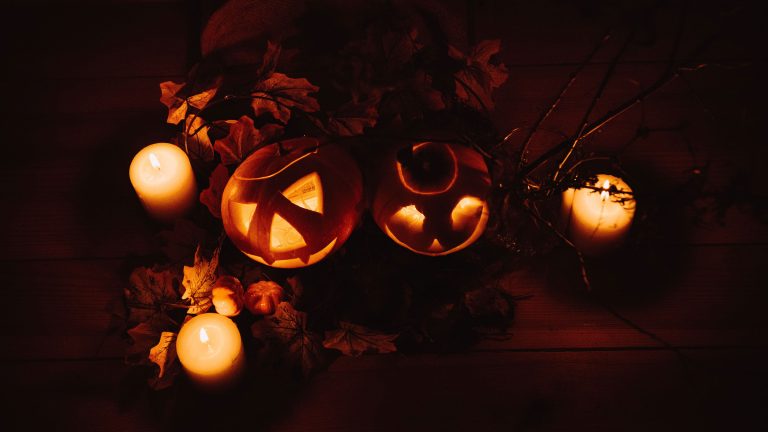
Samhain (pronounced SAH-win or SOW-in) is an ancient Gaelic festival that marks the end of the harvest season and the beginning of winter Halloween customs turned up in other American colonies. Massachusetts sat them out. Anglican and Lutheran churches kept All Saints' Day. Maryland's Catholics did too. In the South, Scotch-Irish settlers, Scots who had lived in northern Ireland, sometimes went out in costume and called it guising. The Puritans who settled here took a dim view of all of it. The Commonwealth Museum's history of the holiday traces the night to Samhain, the Celtic new year on November 1, when the dead of the past year were thought to come back for a verdict. Disguises, and a candle in a hollowed turnip, were supposed to keep the spirits away. In the eighth century, the museum says, Pope Gregory III set All Saints' Day on November 1. The eve became All Hallows Eve. Halloween is that name, worn down. The church would rather you dressed as a saint. What people actually did on October 31 still changed from one place to the next. Artist's depiction of Pope Night in Boston, 1768 Pope Night was a different riot Boston already knew how to wreck an evening in early November. The occasion was Pope Night, November 5. Old North Church traces it to Guy Fawkes Day, the anniversary of the 1605 plot to blow up Parliament. The North End and the South End each built an effigy, the pope and often the devil, and hauled it through the streets. The crowds met and fought for the figures. North End winners burned them on Copp's Hill. South End winners burned them on the Common. Isaiah Thomas, who was in the fights, wrote that broken heads were not infrequent. In 1764 a boy was run over by a cart and killed. Houses along the way were expected to hand over money. Skip the payment and the windows could go. That is still not Halloween. The Commonwealth Museum says the connection to later Halloween pranks is not clear, and that Guy Fawkes Day is a stretch as an origin. Pope Night was an anti-Catholic riot with its own date. In 1775 George Washington ordered the army to stop burning the pope in effigy. The colonies wanted Catholic allies in Canada. Old North treats that order as the end of the holiday in Boston. Traditional Irish halloween Jack-o'-lantern made out of a turnip. Photo by rannṗáirtí anaiṫnid County Cork, then a pumpkin The customs Bostonians now recognize arrived with Irish immigrants in the nineteenth century, after the Great Famine began in 1845. In County Cork, the museum says, people wore costumes on Halloween and announced themselves at a house with cow's horns. Food or a drink from the household was supposed to bring prosperity. The lantern was a turnip with a candle in it. Once those immigrants were here, a pumpkin did the job better. There is more face on a pumpkin than on a turnip, and less of a fight. They did not invent trick-or-treating. One older thread, also in the museum's account, is the medieval soul cake: bread for the poor, prayers for the dead in exchange. The pillowcase version came later. Costumes, a stop at the door, and a lantern were the Irish Halloween traditions that Boston actually got. The Globe caught on in 1884 On October 31, 1884, the Boston Daily Globe ran "Why Thousands Will Think of Erin Tonight." The Commonwealth Museum cites the headline. Halloween historian Lesley Bannatyne quotes the article. It describes Ireland, not a candy route through Boston: a church fast that fell apart when the party started, colcannon sent from the country, and "parties of young men and their sweethearts" going house to house among relatives and friends. The candy holiday was still ahead of that. Newspapers, magazines, and clubs from the Scouts to the Rotary spread Halloween in the twentieth century, the museum says. Trick-or-treaters were being spotted in Wellesley by the 1920s. After the Second World War, the baby boom made it a product. Manufactured costumes and decorations arrived then.

Boston’s weather beacon has a special signal for the Red Sox

Boston’s weather beacon has a baseball setting. The red and blue lights on the old John Hancock building were designed to announce a forecast, but a flashing red signal during baseball season has also meant a Red Sox home game was postponed. Apparently rain is not specific enough until it affects Fenway. The beacon sits on the Berkeley Building at 200 Berkeley Street in Back Bay. It is the older Hancock building, not the much taller glass tower at 200 Clarendon Street. If you are looking for the lights on the glass one, you have the wrong Hancock. How to read Boston’s weather beacon The basic weather-beacon code uses two colors and two behaviors. Steady blue means clear weather. Flashing blue means clouds. Steady red means rain, while flashing red is the snow signal. Notice both parts before trying to read it. Blue alone does not supply the whole message, and neither does red. Whether the light holds steady or flashes makes the difference between two forecasts. The familiar rhyme pairs a clear view with steady blue, clouds due with flashing blue, rain ahead with steady red and snow instead with flashing red. You do not need to recite it on the sidewalk. Remembering the colors and the flashing pattern will do. The system gives you a broad category rather than a detailed forecast. It cannot tell you how many inches of snow to expect, what time the rain will start or whether your particular walk home will be dry. That was never information two colors could comfortably carry. The lights arrived after the building The Berkeley Building opened in 1947. Its weather beacon first lit on March 15, 1950, according to Atlas Obscura’s history of the structure. The beacon rises above the office tower, making the signal visible beyond the immediate block. A building that communicated by colored light was a useful idea before everyone carried a screen. Someone who knew the code could glance up and get the message without buying a paper or waiting for a broadcast. The weather service has not been continuous. The beacon went dark during the 1973 energy crisis and returned in 1983. In 2020, steady blue was used as a tribute to hospital workers during the pandemic, temporarily giving a familiar color a different meaning. Those interruptions are a reason to understand the lights as a piece of Boston history, rather than treat every photograph of them as an exact record of the weather. A blue beacon in an old image may be carrying a message other than clear skies. The Red Sox got their own signal The baseball connection extends beyond a rainout. After the Red Sox won the 2004 World Series, the beacon flashed red and blue together. The usual forecast could wait. The combination was repeated for the championships in 2007 and 2013. It is a pleasingly Boston use of an office-building fixture: two colors responsible for clouds and precipitation recruited to announce that the Red Sox had done something worth looking up for. The Curse of the Bambino story explains why 2004 carried so much weight. The championship ended a wait that had lasted since 1918, long before the Berkeley Building or its lights existed. Look for the older Hancock The two Hancock buildings can make directions confusing. The Berkeley Building is the one with the stepped top and beacon. The reflective glass skyscraper is 200 Clarendon, the later tower associated with the same company. The beacon belongs in a wider collection of Boston signs and signals that people recognize without necessarily knowing their original job. A corporate building can become a reference point for people who have never worked inside it. View the lights from a public sidewalk or another open vantage point, and give yourself a few seconds to distinguish steady from flashing. For a game-day decision, check the Red Sox’s announcement directly. The skyline is good at shorthand, but it cannot explain what happens to your ticket.

Boston’s streets make absolutely no sense

Take a wrong turn in downtown Boston and the city seems to rearrange itself behind you. A street bends without warning, changes its name, feeds into something called a square, and sends you back toward the place you just left. The usual explanation is that Boston paved over cow paths. It is repeated so often that it sounds like established history. The better explanation involves a small peninsula, private property, enormous amounts of fill and several towns that became Boston after laying out streets of their own. Boston’s streets started on a much smaller piece of land When English colonists established Boston in 1630, the Shawmut Peninsula was connected to the mainland by a narrow strip called Boston Neck. The route across it roughly followed present-day Washington Street toward Roxbury. There wasn't much room to leave town. The National Park Service describes the original peninsula as a place of three prominent hills, wetlands and estuaries. This was Massachusett land long before English settlement. Much of the ground that now seems inseparable from downtown Boston was still water. Early streets connected the places colonists needed to reach: houses, meetinghouses, markets, docks and fresh water. Routes fitted around slopes, shorelines and property. What served a small port town did not anticipate delivery trucks or someone trying to make a left turn on the way to a parking garage. The cows had other things to do Cows and sheep really did graze on Boston Common. The city eventually banned grazing there in 1830. That history explains why livestock belongs in the story, but it doesn't establish that wandering cattle determined the street plan. Ralph Waldo Emerson helped the idea stick. As Boston.com recounts in its examination of the cow-path story, he wrote, “we say the cows laid out Boston.” The article's historians point instead to fresh water, property boundaries and the original terrain as practical reasons for the early routes. A path used by animals might also have been used by people. That possibility is a long way from explaining an entire city. The cow story survives because it is easier to remember than the history of somebody else's property line. Boston made more land and gave it different streets Boston spent centuries creating room to grow. Hills were cut down, tidal areas were filled and the shoreline moved outward. The Leventhal Map & Education Center's account of landmaking describes both the physical work and the financial incentive: new ground could become valuable property. The result is particularly easy to see in Back Bay. Its rectangular blocks look different from the older streets downtown because they came from a different process. Planners could set out a street system for land being created, rather than fit roads around an existing waterfront town. Arthur Gilman produced his Back Bay plan in 1856. Filling began the following year and continued for almost four decades, according to the Friends of the Public Garden's history of Commonwealth Avenue Mall. The broad central mall gave the new neighborhood a long, planted space between its roadways. Arlington, Berkeley, Clarendon, Dartmouth, Exeter, Fairfield, Gloucester and Hereford streets even proceed alphabetically. Commonwealth Avenue, Newbury Street and Boylston Street run alongside one another. For a few blocks, Boston gives you a system you can remember. Boston also bought into other towns' street maps Today's city includes communities that developed separately. The city's annexation timeline records Roxbury joining in 1868 and Dorchester in 1870. Charlestown, Brighton and West Roxbury followed in 1874. Hyde Park joined in 1912. Those places already had roads, town centers and property boundaries. Becoming part of Boston did not erase them or require their streets to meet a Back Bay grid. A trip across the city can take you through several different systems without a sign announcing the change. Later traffic rules added another complication. One-way streets and turn restrictions can make a short route on foot a much longer trip behind the wheel. Knowing where a place is and knowing how to drive there are separate accomplishments. To see the difference without dealing with either problem, start on foot in Back Bay. Follow its rectangular blocks, then cross toward Beacon Hill's older, narrower streets. The change in the map is right under your shoes.

Boston Explained →